
A Flavour of Medieval Rauceby
NORTH RAUCEBY SHRUNKEN MEDIEVAL VILLAGE
RURAL LIFE
Villages did not appear in their present form until the late Anglo-Saxon period and early Middle Ages. Although much of North Kesteven had already been settled by farming communities for thousands of years, the population was lower then and settlements tended to be smaller and more scattered. With the development of agriculture in the Middle Ages, settlements grew, often along a road, stream or around a green. Most medieval villages in North Kesteven have survived to form the basis of modern settlements, with the original shape of the village still detectable at their centres.
Some medieval villages became deserted, or have shrunk greatly in size over the centuries. Abandonment was sometimes due to natural causes such as the Black Death or repeated crop failure. There were also many cases in which the Lord of the Manor simply evacuated his tenants and turned the land over to pasture for sheep-rearing. The remains of deserted villages often survive in pasture and the position of building platforms and plot boundaries can occasionally be traced. Similar earthworks can be found on the edges of shrunken villages.
Beyond the living areas lay the village fields. Ridges and furrows formed by the plough as it turned soil over to one side can be seen in the picture below. The ridges and furrows were grouped into strips within two or three large open fields. They were shared out as smaller units that could be farmed by different individuals and, if required, carried different crops. Generally the deeper the ridge and furrow, the longer the field was in use. The furrows also assisted in drainage, and for this reason the ridge and furrow technique continued to be practiced in some places into the eighteenth and nineteenth centuries.
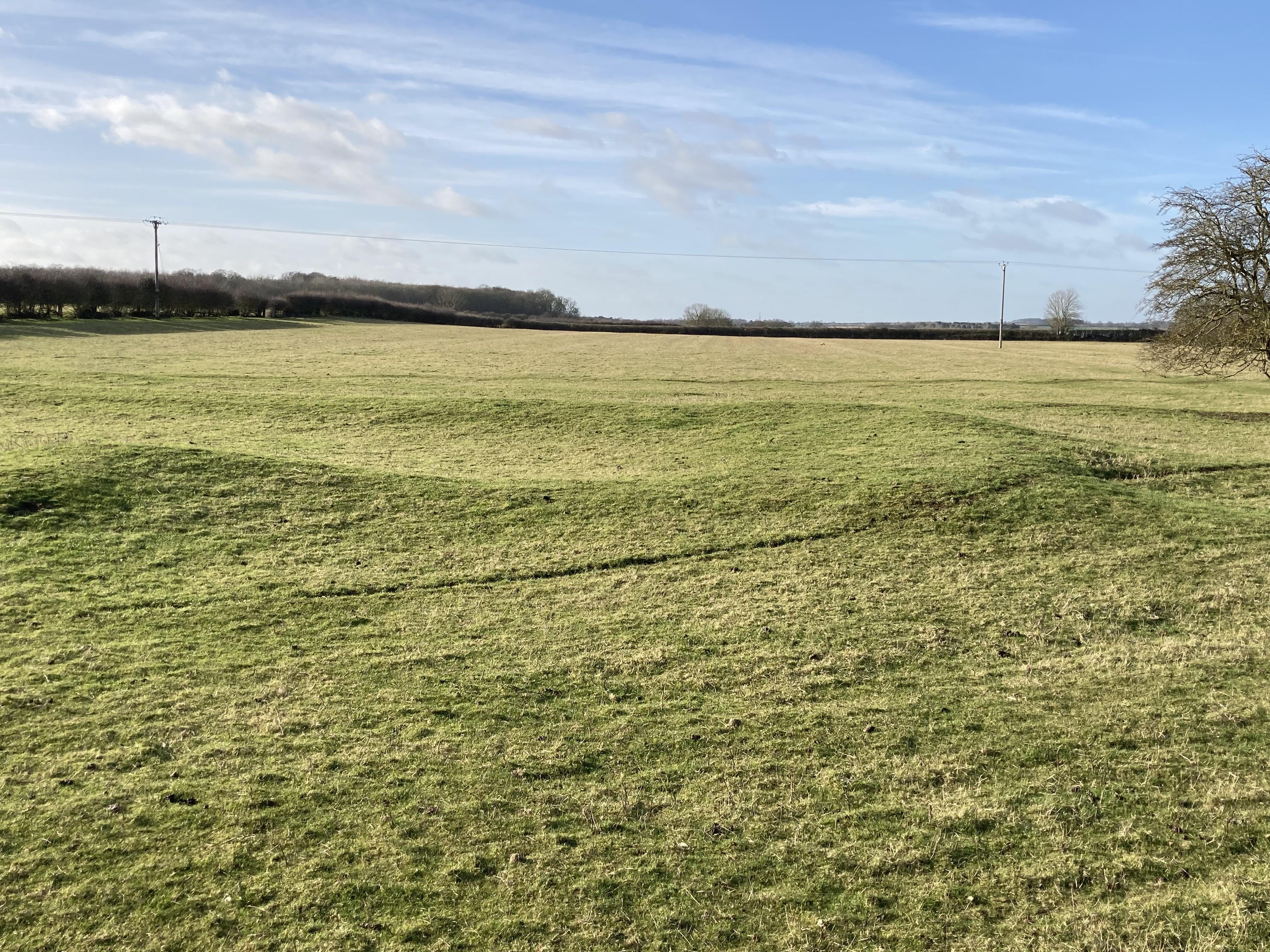
As well as the cultivated fields, pockets of pasture, meadow and woodland provided grazing and supplies of timber, rushes and other materials.
| The Medieval Farming Year | |
|
Januar Februar Marche Aprile Maii Junii Julii Auguste September October November December |
By thys fyre I warme my handys; And with my spade I delfe my landys. Here I sette my thynge to sprynge: And here I here the fowlis synge. I am as lught as burdie in bowe; And I wede my corne well mow. With my sythe my mede I mowe; And here I shere my corne full lowe. And with my flayll I erne my brede; And here I sawe my whete so rede. At Martynesmasse I kylle my syne; And at Christemasse I drynke redde wyne. |
NORTH RAUCEBY SHRUNKEN MEDIEVAL VILLAGE
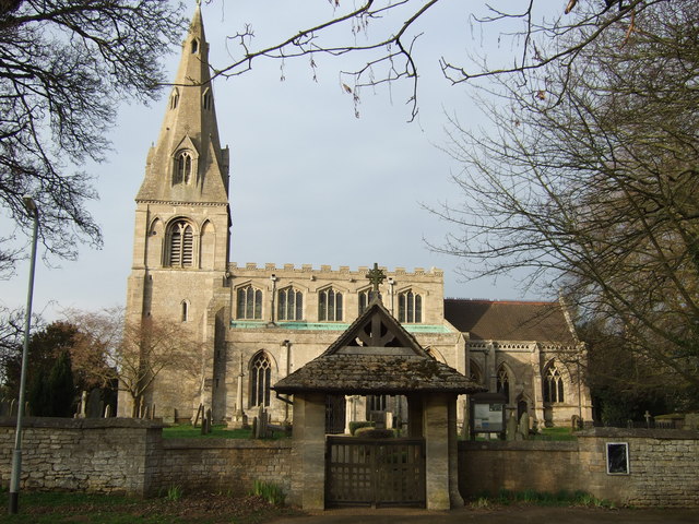
This settlement occupies one of the highest points in the district and the spire of the Medieval Church of St Peter is something of a landmark. The village and church were in existence at the time of the Domesday Book of 1086 and were, at the time of the Norman Conquest, taken from the Saxon landowner by the King and given to his Norman favourites.
The village covered a larger area in the Middle Ages than today. Gradually the village shrank, leaving only grassy mounds where dwellings once were. The best preserved area of the shrunken village is to the north west of the modern village. A spring near the tree-line in the picture below is called ‘Drop Well’ and would have provided a water source for the village and farmers. In the south eastern side of the field, are earthworks of medieval houses and yards where the ordinary people lived and worked, lining a hollowed-out village street.
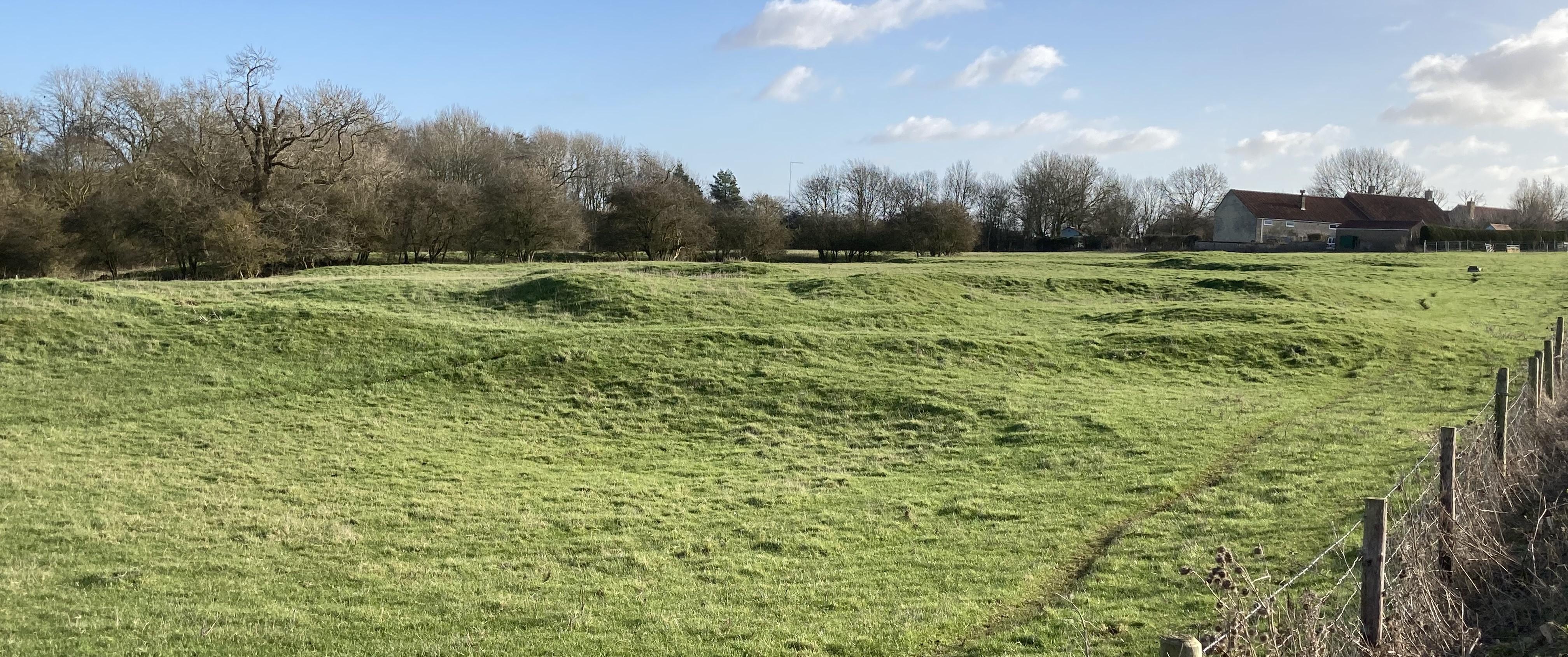
A volunteer excavation was carried out here in August 1999. Three trenches were excavated over some of the earthworks in the north western part of the field. The evidence suggests that this was an area of farm buildings, pens and ponds within a square, walled enclosure. The rectangular earthwork in the field, on the other side of the track, may be the remains of a manor-house, in which case this may have been the Lord of the Manor’s residence and farmyard.